
Weather & Disasters · 1 views
SPC Severe Thunderstorm Watch 635 Status Reports
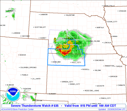
WW 0635 Status Updates STATUS REPORT ON WW 635 SEVERE WEATHER THREAT CONTINUES RIGHT OF A LINE FROM 25 W LBF TO 15 NE MCK TO 35 SW EAR TO 30 WNW CNK. ..LYONS..08/28/26 ATTN...WFO...GLD...GID...

AI Summary
The Storm Prediction Center issued a status update for Severe Thunderstorm Watch 635, noting that the severe weather threat remains active along a line extending from 25 mi west of LBF to 15 mi northeast of MCK, then 35 mi southwest of EAR to 30 mi west‑northwest of CNK. The report lists the affected Kansas counties, including KSC023, 039, 063, 065, 109, 137, 141, 147, 153, 163, 179, 181, 183, 193, and 280540. No further developments are provided.
Read full article on SPCAI summaries can be wrong sometimes—always verify important details using the source article.
How AI & Automation are usedMore from Weather & Disasters
Continue reading recent Weather & Disasters coverage
- There are no tropical cyclones at this time.Continue reading
- SPC - No watches are valid as of Fri Aug 28 06:13:02 UTC 2026Continue reading
- Special Weather Statement issued August 28 at 1:07AM CDT by NWS Hastings NEContinue reading
- Severe Thunderstorm Warning issued August 27 at 11:37PM MDT until August 27 at 11:45PM MDT by NWS North Platte NEContinue reading
Support HappeningNow
Independent AI-powered news analysis is reader-supported. Your contribution helps cover infrastructure, summaries, and continued platform development.
Support HappeningNow