
Weather & Disasters · 2 views
SPC MD 2301
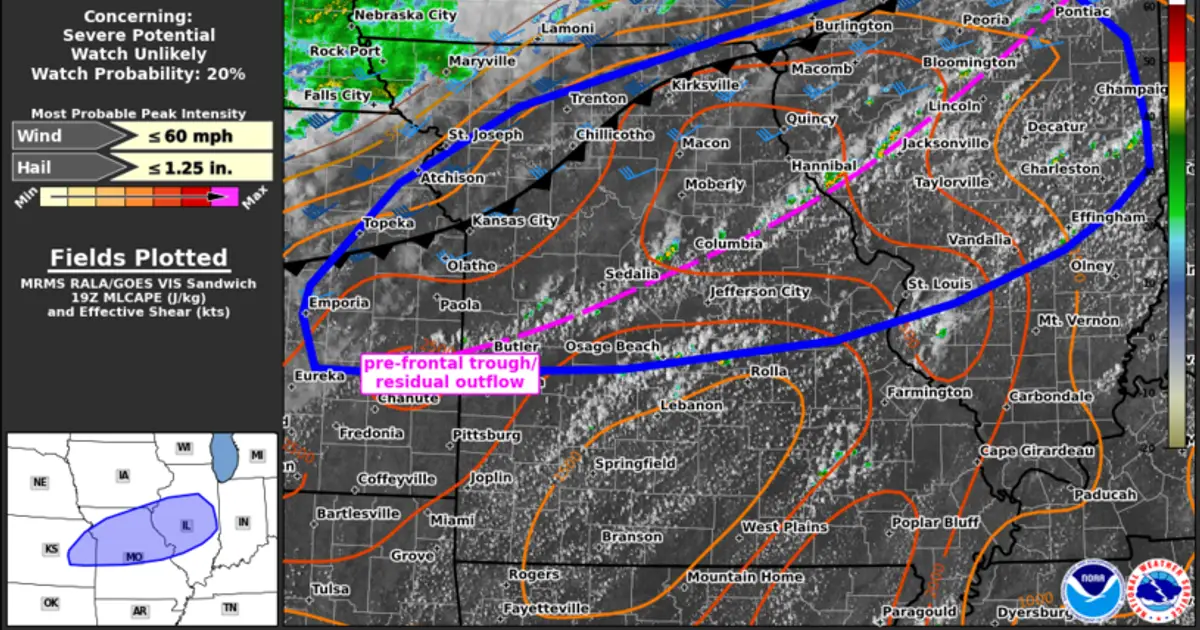
Mesoscale Discussion 2301 NWS Storm Prediction Center Norman OK 0235 PM CDT Tue Sep 15 2026 Areas affected...northeast KS into northern/central MO and central IL Concerning...Severe potential...Watch unlikely Valid 151935Z - 152130Z…

Summary
Mesoscale Discussion 2301 NWS Storm Prediction Center Norman OK 0235 PM CDT Tue Sep 15 2026 Areas affected...northeast KS into northern/central MO and central IL Concerning...Severe potential...Watch unlikely Valid 151935Z - 152130Z Probability of Watch Issuance...20 percent SUMMARY...Thunderstorm activity will increase through late afternoon. Sporadic strong wind gusts may accompany this activity through the evening hours. A severe thunderstorm watch is not currently expected. DISCUSSION...Initial thunderstorms are developing along a pre-frontal trough and residual outflow from eastern KS through north-central MO into IL this afternoon.
AI summaries can be wrong sometimes—always verify important details using the source article.
How AI & Automation are usedMore from Weather & Disasters
Continue reading recent Weather & Disasters coverage
- There are no tropical cyclones at this time.Continue reading
- Flood Advisory issued September 15 at 2:20PM MDT until September 15 at 5:15PM MDT by NWS Albuquerque NMContinue reading
- Special Weather Statement issued September 15 at 3:18PM CDT by NWS Midland/Odessa TXContinue reading
- Gale Warning issued September 15 at 11:39AM AKDT until September 16 at 4:00PM AKDT by NWS Juneau AKContinue reading
Support HappeningNow
Independent AI-powered news analysis is reader-supported. Your contribution helps cover infrastructure, summaries, and continued platform development.
Support HappeningNow