
Weather & Disasters · 1 views
SPC MD 2270
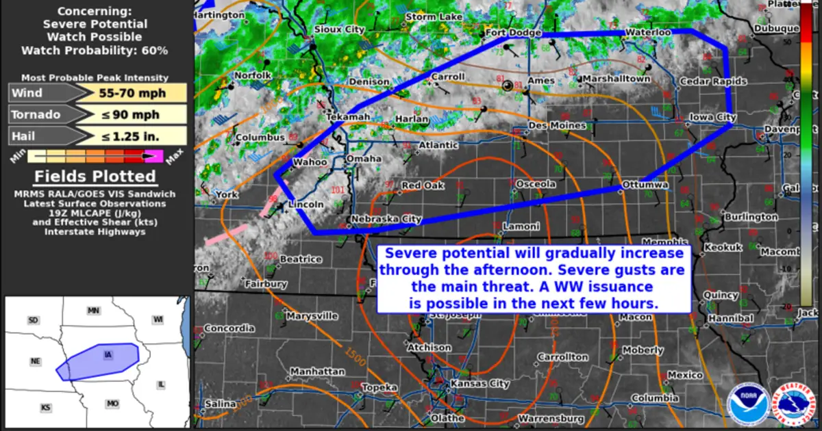
Mesoscale Discussion 2270 NWS Storm Prediction Center Norman OK 0249 PM CDT Tue Sep 08 2026 Areas affected...portions of extreme eastern Nebraska into central Iowa Concerning...Severe potential...Watch possible Valid 081949Z - 082145Z Pr…

AI Summary
A mesoscale discussion issued by the Storm Prediction Center indicates that thunderstorms are expected to expand and intensify across portions of extreme eastern Nebraska and central Iowa as a surface cold front moves in. The discussion notes a severe weather potential with a 60 percent probability that a watch could be issued for the area between 19:49 UTC and 21:45 UTC on September 8.
AI summaries can be wrong sometimes—always verify important details using the source article.
How AI & Automation are usedMore from Weather & Disasters
Continue reading recent Weather & Disasters coverage
- There are no tropical cyclones at this time.Continue reading
- Severe Thunderstorm Warning issued September 8 at 5:20PM CDT until September 8 at 5:30PM CDT by NWS Jackson MSContinue reading
- Flood Advisory issued September 8 at 5:35PM EDT until September 8 at 6:30PM EDT by NWS Melbourne FLContinue reading
- Hazardous Seas Warning issued September 8 at 1:55PM PDT until September 9 at 5:00AM PDT by NWS Medford ORContinue reading
Support HappeningNow
Independent AI-powered news analysis is reader-supported. Your contribution helps cover infrastructure, summaries, and continued platform development.
Support HappeningNow