
Weather & Disasters · 1 views
SPC MD 2172
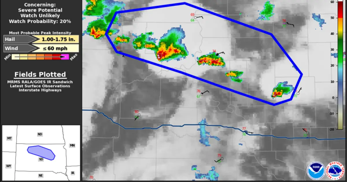
MD 2172 CONCERNING SEVERE POTENTIAL...WATCH UNLIKELY FOR NORTH-CENTRAL INTO EAST-CENTRAL SD Mesoscale Discussion 2172 NWS Storm Prediction Center Norman OK 1058 PM CDT Sat Aug 29 2026 Areas affected...north-central into east-central SD C…

AI Summary
A Mesoscale Discussion issued by the Storm Prediction Center at 10:58 PM CDT on 29 August 2026 noted a severe weather potential over north‑central to east‑central South Dakota. The discussion indicated that a tornado or severe thunderstorm watch was unlikely, with only a 20 percent probability of issuance during the valid period from 03:58 UTC to 05:00 UTC.
Read full article on SPCAI summaries can be wrong sometimes—always verify important details using the source article.
How AI & Automation are usedMore from Weather & Disasters
Continue reading recent Weather & Disasters coverage
- There are no tropical cyclones at this time.Continue reading
- Dust Advisory issued August 29 at 9:57PM MST until August 29 at 10:15PM MST by NWS Phoenix AZContinue reading
- Special Weather Statement issued August 29 at 10:55PM MDT by NWS Great Falls MTContinue reading
- Special Weather Statement issued August 29 at 11:14PM CDT by NWS North Platte NEContinue reading
Support HappeningNow
Independent AI-powered news analysis is reader-supported. Your contribution helps cover infrastructure, summaries, and continued platform development.
Support HappeningNow