
Weather & Disasters · 3 views
SPC MD 2384
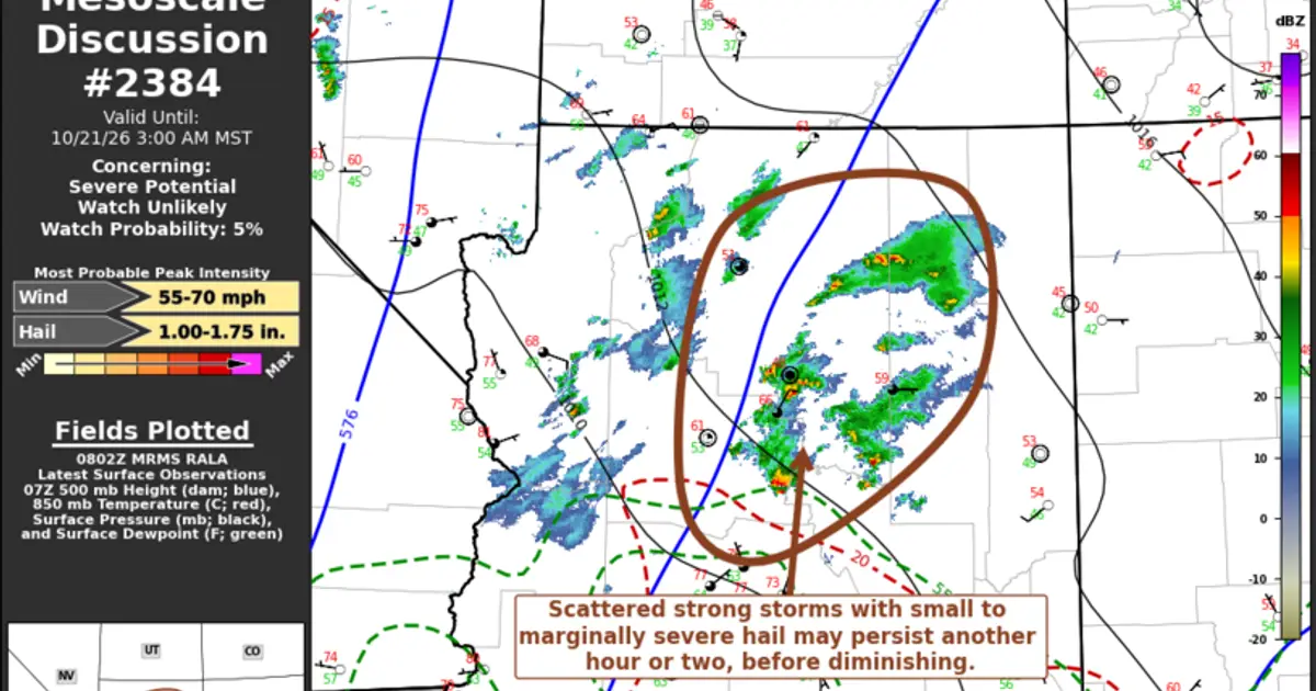
Mesoscale Discussion 2384 NWS Storm Prediction Center Norman OK 0305 AM CDT Wed Oct 21 2026 Areas affected...parts of central and northern Arizona Concerning...Severe potential...Watch unlikely Valid 210805Z - 211000Z Probability of Watch…

Summary
Mesoscale Discussion 2384 NWS Storm Prediction Center Norman OK 0305 AM CDT Wed Oct 21 2026 Areas affected...parts of central and northern Arizona Concerning...Severe potential...Watch unlikely Valid 210805Z - 211000Z Probability of Watch Issuance...5 percent SUMMARY...Scattered strong thunderstorm development posing a risk for small to marginally severe hail may persist another hour or two, north of the Greater Phoenix area into the Mogollon Rim vicinity south of Flagstaff, with diminishing potential through 2-4 AM MST and into/across northern Arizona.
AI summaries can be wrong sometimes—always verify important details using the source article.
How AI & Automation are usedMore from Weather & Disasters
Continue reading recent Weather & Disasters coverage
- There are no tropical cyclones at this time.Continue reading
- Severe Thunderstorm Warning issued October 21 at 2:00AM MST until October 21 at 2:30AM MST by NWS Flagstaff AZContinue reading
- Severe Thunderstorm Warning issued October 21 at 1:54AM MST until October 21 at 2:15AM MST by NWS Phoenix AZContinue reading
- Severe Thunderstorm Warning issued October 21 at 1:13AM MST until October 21 at 1:45AM MST by NWS Flagstaff AZContinue reading
Support HappeningNow
Independent AI-powered news analysis is reader-supported. Your contribution helps cover infrastructure, summaries, and continued platform development.
Support HappeningNow